The David A. Farrow
Magical History Tour of Charleston
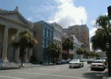
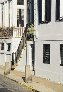
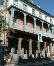
Probably one of the first things you'll notice as you walk or
ride around our city is the unique style of the houses. Many of the
houses are one single room wide, with porches facing either south or
west and front doors opening onto the porch, rather than the main hall
of the house. Called piazzas, they come in all sizes, from the simplest
structures to very grand mansions. These houses are known as Charleston
"single houses."
Many tour guides in the city would have you believe that the
houses are one single room wide because Charlestonians were originally
taxed on the frontage; however, there is nothing in the tax records of
the day to support that theory.
Our premise is that since Charleston was a walled city, as many
houses as could be crowded onto a street were jammed together. As the
city spread beyond the walls, this conservation of space became a habit;
besides, we were crowded into the peninsula. Charleston was one of four
walled cities in North America, and the only English walled city on the
continent.
Charleston's wall was built in 1703 as a response to fear of the
French, the Spanish and the Native Americans. It was 12 feet high and
ran from where the Circular Congregational Church is today (the corner
of Cumberland and Meeting Streets) to where the Nathaniel Russell House
is today (below the corner of Tradd and Meeting Streets), to where High
Battery is today (where East Bay transforms itself into East Battery),
and back up to where the U.S. Customs House is today (the corner of
Market and East Bay Streets). You will find markers at each location
denoting what bastions they are, and the names are those of four of the
Lords Proprietors.
The wall, built out of brick and tabby, oyster shells, was
erected as a response to the threat of attack, and it did a grand job.
The trouble
was, however, that there were creeks on both the north and
south boundaries of the wall: the Cooper River on the east side, and the
only way out was a drawbridge at the corner of Broad and Meeting where
the "Four Corners of Law" are today. There was marsh all
around. If you lived outside the wall, you had to walk all around the
city and then through the city simply to get to your next door
neighbor's house, so eventually it had to be torn down, mainly because
it was in the way.
If you stand at the beginning of High Battery and look south, or
at the corner of Tradd and Meeting and look west, you'll notice that the
houses are relatively spread apart--look in the other direction and
you'll see the houses are all built flush with one another. At that
point, you are either entering or leaving the walled city. The walled
city was built on high ground, five feet above high water. So, the lots
were drawn out deep to fit more houses on the street. When the wall came
down, the room to develop was halted by the fact that they were
surrounded by salt marsh, which grows in what as known as plough (pluff)
mud, a dark, thick mud the consistency of toothpaste that is found from
Georgetown, SC, to Savannah, GA. There was no room, so they positioned
the houses to the side.
Also, a house one room wide is perfect for ventilation. So are
the porches, all facing south or west. This is for two reasons: one, the
construction catches the prevailing breezes, which are westerly, and the
other is that during the hottest part of the day, the sun beats
unmercifully down on the south and west sides of the house. For privacy,
the doors open onto the porch, very much like Spanish courtyards.
Another aspect much ignored about Charleston single houses are
the east and north sides of the houses. When you look at them very
closely, you'll note that there is a dearth of windows on those sides.
Some say it's to keep the cold wind from blowing through the house, but
another theory may apply. It was considered extremely rude to look out
of your east or north window. You could well see onto your neighbor's
west or south porch and he could well be "undressed." Now of
course, a proper Charlestonian's idea of being undressed was a lot
different from ours. A proper Charlestonian's idea of being undressed
was to take off his jacket. Can you imagine never taking off your coat,
even in the middle of the summer?
THE
TOUR BEGINS

Now, we're ready to begin the tour with the vegetable man.
Let's venture forth into one of the most beautiful cities in
America. Turn down Church Street to South Market Street and take a left.
Stop for a minute in the market to admire the sweetgrass baskets. These
women have plied their craft for over 1,000 years. Their mothers taught
them this art and their mother's mothers on back through time. Sad to
say, the art of weaving these baskets is rapidly dying out, due to two
main reasons. One, it used to be that the mothers would generally only
teach the daughters, pass the intricacies down only to their kin, but
lots of the young people aren't interested in learning the painstaking
detail, claiming that the amount of money received for the work is not
really worth their time. The art is becoming so rare that the
Smithsonian Institution was recently reported to have bought two baskets
for about $1,500.
Secondly, the artform is dying out because of the paucity of
sweetgrass that's available. The baskets themselves are made from pine
straw, palmetto fronds and sweetgrass. Sweetgrass grows out in marsh,
which is composed of pluff mud. We here in South Carolina have been
doing something criminally insane for the past 25 years or so. We have
been developing our wetlands and bulldozing our sand dunes to build
beach houses.
Now, back in 1989, we had a small storm, a breeze of Biblical
proportions, if you will, called Hugo. One would have thought that there
was a lesson learned from all of that, but unfortunately developers are
still allowed to rebuild what was destroyed right back where it was
destroyed. What's this got to do with the baskets? Well, the spores for
the sweetgrass are in the sand dunes, so what's left is rapidly being
developed. In fact, there is a man down on St. Simons Island, GA, who
has discovered a cache of sweetgrass on his land. Once a month, he opens
his land up for an hour. The women line up like the Oklahoma landrush,
and pick as much as they can in that one hour, and that's their supply.
Many of them are having to go as far away as the Florida Everglades to
get their sweetgrass. Walking around the city, you will see these
sellers scattered about. Do not take pictures unless you ask them, or
buy something from them. Some of them--though not all--believe that it
steals your soul.
The
City Market
Not very long ago the Market was completely derelict. Before
that, for many years the market sold retail food, and most of the food
eaten in the city was sold here. Stalls were filled with butchers,
bakers and vegetables, and plenty of fish, oysters, crabs and shrimp.
Then with the new sanitation laws, the need for proper refrigeration,
and the advent of the chain stores, the vendors left and eventually
there were only the vegetable women at the far end of the market, with a
few shrimp men coming in with their trucks early in the morning. Up
until the late 1970s, both sides of Market Street were lined with
wholesale produce companies. After that the market was completely
deserted, the haunt of derelicts and winos. The City mumbled about
tearing it down. Then two enterprising women started having flea market
sales here on Saturday mornings. Suddenly everybody wanted a piece of
the action. Space was available on a first come basis. We'll come back
to the market at the end of the tour.
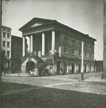

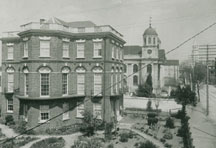
Market Hall in the days of cobblestone streets and today
Charleston is a port, and in the days of sailing ships the
prevailing winds brought the square riggers straight here from Europe.
They were loaded with rice, cotton, naval stores from the great pine
forests, and sailed home again. So Charleston used to be inundated with
sailors. During Prohibition, there was a great deal of rum-running in
our many marshy creeks. Confiscated cargoes were brought here to be
destroyed. One young engineer who worked here on designs for the Inland
Waterway, used to manage to find bottles that didn't break when they
were thrown on the heap. He took pints of Four Roses to several of his
debutante friends. The debutantes' mothers were alarmed, telephoned each
other in some consternation. Then they confiscated the bottles and
consumed the contents themselves.
Go west one block to State Street then take a left onto State
Street. Just after you get past Cumberland on State Street, look over to
your left and you'll see a courtyard and a cast iron gate. In 1978, that
was the barn for a local carriage company. There was a large derelict
warehouse where the horses and mules were housed. See how well this
whole structure blends in with the rest of the city? That's because we
have the strictest Board of Architectural Review (BAR) in the nation.
You actually have to seek their permission to do anything to your house
anywhere on the peninsula. This includes painting your shutters. If
their permission is not obtained, they'll fine you. If you don't pay the
fine, they will put you in jail!
If you walk down the street a little farther, right past Lodge
Alley, you'll come to a house on your left with large disks in between
each floor. These are earthquake bolts. You are, no doubt, going to be
delighted to know that right now you are on one of the worst earthquake
faults in North America: the Woodstock fault.
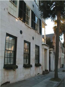
Notice the earthquake bolts in the house.
On August 31, 1886, the bells of St. Michael's Church on Broad
Street rang three times to signify that it was 9:45 in the evening. It
was very peaceful; the city was in its dressing robes and nightcaps and
everyone was getting ready for a quiet night's slumber. Seven minutes
later, Charleston was slammed by one of the most devastating earthquakes
that ever hit the continent. Even today experts argue whether it was
anywhere from 7.7 to 8.5 on what is now the Richter Scale. It lasted for
eight minutes. (To give you an idea on how powerful it was, the one that
occurred in San Francisco in 1989 was 6.9 and only lasted for 13
seconds!)

Meeting Street Hibernian Hall after the earthquake and today.
Meeting Street itself was rent asunder and geysers of sand went
spewing 70 feet in the air. The editor of the News and Courier was
walking down Broad Street, headed to put the paper to bed when he heard
a rumbling behind him the likes of which he had never heard before. He
turned around and, much to his horror, he watched the street buckle
towards him in waves ten feet tall.
There were a number of aftershocks lasting over a period of
days--an aftershock the next day was reported to have cracked a church
in Boston. The shocks were claimed to have been felt as far away
as Chicago's Loop and the Bahama Islands.
The first shock came along and everyone ran from their houses to
see just what on earth was going on! It was the second shock that killed
people. The second shock immediately followed it and 15,000 chimneys
toppled to the ground. Out of a population of around 35,000, fewer than
100 people died. At the end of it all, most of the city lay in total
ruins. Nobody dared venture back into their houses for weeks. The entire
city endeavored to live in the public parks in tents, although it should
be noted that the dowagers also brought their oriental rugs, tea
services and servants along with them. No need letting a little thing
like a natural disaster halt the march of civilized behavior.
At first there was speculation that all we could do was simply
just raze the city--tear it down and start over. There are those that
would have you believe that there was a certain high mindedness and
moral certitude that we should rebuild everything for posterity. That
came later. The real reason
was that there was simply no money. During the 1870s, we went through
Reconstruction, which was the bleakest period of our history. In the
1880s we went through a depression that drove the price of agricultural
products through the basement, and--just to top things off--in August of
1885, we endured two hurricanes that ripped the city apart. We were just
starting to build everything back.
What we had to do was reconstruct the buildings from the rubble,
brick by brick, board by board, piece by piece, fitting everything
together like jigsaw puzzles. So actually, what you see around you are
the original buildings--they're just somewhat rearranged. In the midst
of this phoenix-like activity, they inserted these long iron rods in
between each floor of each building. As you can see in the middle of the
disks, which are actually washers, are turnbolts or turnbuckles. When
everything was ready, they turned these
turnbolts ever - so
- slowly and
the houses
groaned their way back into shape ever so gradually. Now of
course, it's not known how well this is going to work next time.
Geologists predict that the Charleston area will have another severe
quake within 20,000 years.

St. Philips Episcopal Church just after the earthquake and today.
Queen
to Chalmers Street
Walking towards Chalmers Street, again look to your left and
you'll see a small alley. This is Unity Alley, which is where the city
entertained George Washington at a banquet in a public house called The
Long Room. When George Washington came to the city in 1791, the city
fathers hosted a banquet for him which is said to have lasted for two
whole days.
Chalmers Street is our longest cobblestone street, one of about
ten in the city. The cobblestones you see were brought over here as
ballast to steady empty British ships as they came over here to get
cotton, rice and indigo. Walk across Chalmers Street and look down the
street to the right in the middle of the block at Number 6 Chalmers.
This was Ryan's Auction Mart which after 1938 was the Olde Slave Mart
Museum until 1986 when the proprietor, Mrs. Miriam B. Wilson, passed
away. During those years, the museum was known to have the most
extensive collection of ante-bellum African-American arts and artifacts
in the entire world. Upon Mrs. Wilson's demise, the collection was sold
piecemeal throughout the world and, sad to say, no longer exists as a
whole. Actually Ryan's Auction Mart was exactly that. Everything from
horses to steamships to slaves were sold there. However, it was not a
slave market in the sense of being exclusively for the sale of slaves.
That's not to say that slaves were not sold. They were indeed. The New
England slave ships would unload right on the docks and wharves, the
slaves would be sold in parcels, then carted off to the street corners
where the individual transactions were carried out.
This was also true of all other goods, and finally in 1853, the
city enacted an ordinance banning the sale of anything on street corners
because of the traffic melee. No slaves were
legally imported after 1804. In response to the law, Thomas Ryan
and his silent partner, James Marsh bought the lot and built a
large warehouse to be used as an auction mart in 1853. It should
be noted that there was no single building or place in the city that was
ever used exclusively for the sale of slaves. It should also be
emphasized that the City Market, now used as a hodgepodge of things
today, was never used to sell slaves. In fact, no slave was ever sold on
that land, nor ever could
have been under the law.
Chalmers
to Broad
As
you're walking down to Broad Street, look to your left directly across
the street and then look two houses down and you'll spy a very small
narrow two story building with front steps leading to the second floor.
You'll also probably notice that it is slightly askew, a result of the
earthquake. The building itself was originally a kitchen house. The city
is indeed replete with kitchen houses, and there are two reasons for
this. First, it was best to cook meals away from the main body of the
house for, during the summer, things are hot enough without a kitchen
fire adding to the misery. The other reason is the kitchen fire itself.
Kitchen houses were generally ten feet from the main body of the house
so that if the kitchen house caught on fire, the rest of the house would
not immediately be engulfed in the conflagration Ironically, the house
that the little house served burned down in the late 1950s. As was
pointed out the house is indeed warped. The building is now owned by
Wachovia Bank of North Carolina. Some would suggest that this little
building is the "crookedest bank in town." Others would jest
that if it were the mortgage department, they could very easily put a
"lien" upon your house. Our BAR wouldn't let it be torn down.
Up ahead, you'll see one of the largest structures in the city on
the right hand side of the corner of Broad and State streets, the
People's Building. Many of you taking this tour are probably from large
urban centers. Well, this is one of our skyscrapers. People say that the
law in Charleston is that there can be no building taller than the
tallest church steeple, which is St. Matthews Spire on King Street
across from Marion Square. Actually, the law specifies feet, and St.
Matthews is right at the specification. Many would have you think that
the law is one of aesthetics,but it’s actually one of practicality.
Two-thirds of the peninsula is filled-in marshland, and it would be
insane to build a 60-story building on filled-in pluff mud. They did
build a building at the foot of Broad Street on the other side of the
city back in 1948 and it is now said to be sinking at the rate of about
a quarter of an inch a year.
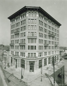
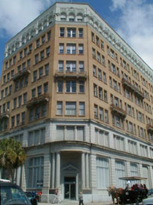
The People's Bank Building
Broad
to East Bay
Walk across Broad Street from State Street and take a left. Look
across the street at the building on the corner across from the Peoples
Building. This was built in 1817 as the Second Bank of the United
States. In 1835 it was acquired by the Bank of Charleston (which later
became the South Carolina National Bank). If you look up on the gable
you'll see a large gilded eagle. State Street was originally Union
Street, and the name was changed long before the War Between the States.
However, there is a certain irony in the fact that in the early 1860s,
we rejected everything about the United States yet left untouched the
largest symbol of federal authority in the city. According to some, The
Bank is the only place in the world that will still redeem Confederate
Bonds at face value.
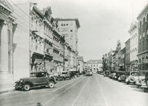
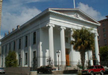
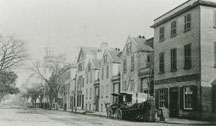
1930's Broad Street and today
Go a little further up Broad to East Bay Street and on the
corner, there is a large brownstone building that again houses a bank.
This is one of about ten stone buildings in the city and was built in
1853. Note the lions' heads that encircle the building in between the
first and second stories. Each lion's face has a different expression!
Carolina First Bank
East
Bay to Elliott
Stand right where you are at the corner of Broad and East Bay
Streets and look across the Street
at the
Old Customs and
Exchange Building. This is the last public building built by the British
in 1771. It has been used as a customs house, a bank, a post office,
coast guard station during World
War II, and best of all--a dungeon!
On December 3, 1773, the Charleston Tea Party took place here
when the citizens banded together to protest the tea taxes. It is this
meeting that is considered the first meeting of the South Carolina
General Assembly and the birth of South Carolina's present government.
The entire building can be toured today, including the dungeon. Walk
across the street from the bank down East Bay Street and across Exchange
Street you will see a building with a red dot on it. This is a liquor
store, and there are those who claim that spirits have been sold from
the building continuously since it was built fore the Revolution.
Originally Harris' Tavern, it has been said that even during
Prohibition, spirits were dispensed with unbroken regularity.
Charlestonians had as much regard for the Volstead Act as they have for
traffic laws today. The row that the tavern is in is called Coates Row,
and the cupola on top of the building is thought to have been an early
lighthouse.

Customs and Exchange Building

Exchange Building after a devastating fire and today.
Notice the lone palmetto tree on the left (the only one to survive the
fire)
Today, a seedling from that tree grows in the original location.
Walk down to Elliott Street and across the street, you'll find
Printer's Row Condominiums on the corner of Elliott and East Bay. This
building originally housed Walker, Evans and Cogswell, the printing
company for the Confederacy. In the early 1980s this building was
converted into condominiums. It's been said that for a couple of years
anything that stood would have been turned into condominiums--even
outhouses would have been fair game for developers. Walker, Evans and
Cogswell still exists, although their headquarters are in North
Charleston. In fact, they still retain the plates to print Confederate
money. You could say that we are eternal optimists in this city.
Elliott
to Longitude Lane
Rainbow
Row
Elliott Street will be discussed later in the tour, but as you
walk from Elliott to Tradd you may notice that all he houses are painted
different colors. This area is called Rainbow Row. There's a
misconception that the houses were painted this way down through
history, but it wasn't until the restoration of the block in the 1930s
that the row attained its pastel hues. Pastel colors, however, have
always been a Charleston tradition. Some say that the pastel colors
reflect the sun better than just plain white, others say that the
tradition of painting houses with color comes from Barbados. The row
itself is thought to have been built from around 1730 to around 1750. It
was built originally as a row of shops downstairs with the shopkeepers
and their families living above the shops upstairs. An unusual feature
of the row is that when it was built originally,
there were no stairs running from the first to the second floor
inside the house, nor was there any back door on the first floor. This
was a measure of security, though.
Back in the early to mid-1700s, this was the waterfront. It was a
pretty rough and tumble place, after all, and you didn't know who was
going to come into your shop. During one period, Charleston actually
encouraged pirates to enjoy the city because they'd spend all their
loot.
By the turn of this century, unfortunately, this whole area was
one mean slum until, in 1931, Mrs. Lionel Legge began to restore 101
East Bay, and after taking myriad layers of paint off one of the rooms
discovered a room paneled completely in cypress wood. Needless to say
this sparked everyone else in the city, and pretty soon the property was
selling like hotcakes. Unfortunately Mrs. Legge was the only one to find
a cypress room, but it did start the whole restoration
process in
the city leading
to the first
preservation society in the world and the next year, the first zoning
laws dealing with preservation.
Longitude
Lane to High Battery
Directly across the street from Longitude Lane is Vanderhorst
Row. (The uninitiated of you would pronounce this like it's spelled:
Van-der-horst, but the proper pronunciation is Van-dross). This row was
built in 1800 by Gen. Arnoldus Vanderhorst and has been claimed as one
of the first tenement or multi-family dwellings in the country. Whether
this is true or not, it is known that at the time it was built,
everybody in the town scoffed, saying nobody would want to live in a
multi-family dwelling.
Longitude Lane is probably the oldest street in its original form
in the city, dating from c. 1680.
Longitude Lane lies along the parallel of Latitude: 32. -46' 35"
above the equator. We can only guess that in a sea-faring city the name
was a joke. It should be noted at this point, though, that in the middle
of Longitude Lane, is indeed Latitude Alley! And it runs North/South!
Cross over to the playground across the street, and walk down to
High Battery, which will be the Promenade by the water. As you walk past
the playground building, you'll come to a building that says
"Private Club." This is the Carolina Yacht Club organized in
1883. The building itself was built around 1830 and was originally used
as a factor's wharf. This is where Northern ships would come down to
purchase cotton from Southern plantation owners. The plantation owners
would bring down huge barges of cotton from the estates up the rivers
and representative bales would brought in for English and Northern
buyers to test. No fools these Southerners. The rooms of the factor's
walk were painted a dark royal blue, so that when the prospective buyers
walked from table to table the cotton would appear much brighter in
contrast.
The building in front of it is the Missroon House which was built
around 1789 and was enlarged in the 1920s for the Shriners. It now
houses the Historic Charleston Foundation. The plaque on the house marks
the Granville Bastion which is the Southeastern corner of the Charleston
Wall.
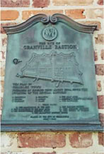
Granville Bastion plaque
Leaving
the Walled City
High
Battery
This
view is possibly one of the most picturesque scenes in America. Facing
the water, the Cooper River is to your left. To your right, the Ashley
River. Directly ahead is Charleston Harbor. Out in the harbor directly
in front of you, you can see a land mass with a lighthouse and a water
tower. This is Sullivan's Island. If you have a chance to drive out to
Sullivan's Island it would be well worth your while. On the part of the
island closest to Charleston, there are a number of houses that were
built in the very early 1800s. They have survived numerous hurricanes
including the latest one in 1989. Probably one of the reasons they have
survived so well is that these houses were built for families, and
nobody had any illusions about hurricanes back in those days.
They weren't built just to sell. At that end of Sullivan's Island
is Fort Moultrie, and, among other things, that is where the largest sea
battle of the Revolutionary War took place.


Charleston's High Battery yesterday and today
Look back out at Sullivan's Island. If there are any ships out
there, note where they are. The shipping channel runs right by the
island. When word was leaked that the British were coming to take
Charles Towne, the populace only had a matter of a couple of days to
fortify the city, so they rushed out to Sullivan's Island, pulled the
Palmetto trees right out of the ground by their roots, and built a crude
fort of Palmetto logs and sand. The next day, on June 28, 1776, the
British stormed the harbor and even though they had 400 cannon to our
40, we won the battle. That's because when the British fired upon the
fort, the cannon balls simply bounced off the logs, or were absorbed by
the logs and sand and failed to explode. That's how we won the battle.
"The
War"
Now, again, that is Fort Sumter located dead flat in the middle
of the harbor. (For an eminently readable blow by blow on the War here
in the city, pick up either The Siege of Charleston by Milby Burton, or
Gate of Hell written by Stephan R. Wise. They are probably the best
treatments done on the subject.)
Most people think that the first shot of the War Between The
States was fired from Fort Sumter. Actually, it was fired at Fort Sumter
from Fort Johnson which is on James Island on the spit of land directly
to the right of Fort Sumter. The first shot was fired at 4:30 a.m. April
12, 1861, and that shot set off a constant barrage between the two forts
for 34 hours. We had no idea this was the beginning of a war. In fact,
most thought it was the end of a war that had lasted for 60 years.
Charlestonians stood on the porches (here we call them piazzas) and had
huge cocktail parties and invited all their friends over to watch the
fireworks. Others stood jammed along the Battery where you are now,
(imagine the ladies if you would, with their hooped skirts and their
parasols) and brought picnic lunches and flasks and made a day of it.
Every time the Confederates got off a particularly rousing shot (to be
fair they applauded the Union shots, too) everybody would toast and
cheer. After 34 hours, the Union surrendered.
Miraculously, it turned out that not single person was killed as
a direct result of the fighting. The only people who died were two
Confederate soldiers who shot off a cannon to salute the Union soldiers
as their ship left the harbor. What a tragedy it didn't end there.
There is one footnote that many of you may find interesting. The
commander of Fort Sumter was Robert
Anderson, but few
people today know that his second of command was a man named Abner
Doubleday, the man credited with inventing baseball. Many have said that
they rue that Doubleday didn't catch it in the fighting. They have been
either wives or Red Sox fans.
Walk down the Battery a bit and look to your right and you'll see
Water Street. Excellent name for this street. It used be called
Vanderhorst Creek because that's exactly what it was. As late as the
l9th century it was a tidal creek. See the three objects that appear to
be hitching posts on the right side of Water Street? Those things aren't
to tie up your horse. Those are tidal markers and bollards to tie up
your boat. Water Street is about two or three feet below mean high tide
sea level. Where you are right now is all landfill!
Water Street hitching posts
Walk a little further down and two houses down on the corner of
Atlantic and East Battery you'll see a house with>two totally different architectural styles,Greek Revival and Roman-esque. Tour guide lore has it that this
is a husband-wife compromise. The theory is that he wanted one style,
she the other. They had the money so, dare to dream, they built both.
(Unless otherwise
indicated, all of the main houses that front the street are indeed
single family dwellings, privately owned.) Back in the early 1980s, this
house was transformed into condominiums.
The
house across Atlantic Street is unusual for Charleston in that it's one
of the few Victorian houses in the city. It has Medieval European and
Chinese architecture blended together and is known in the city as
Chinese Chippendale style. The reason the house was able to be built by
the Draytons in 1885 is that the Drayton family discovered phosphates
along the banks of their plantation on the Ashley River and were among
the first to realize the excellent potential for fertilizer, thus
launching much of the chemical fertilizer industry today.
Next door to the left of the Drayton house is the Edmonston-Alston
House, which is open for tours. The Edmonstons built the house in 1828,
the Alstons bought it in 1838, and the same family has owned and lived
in it since then. The family now lives on the third floor, while the
rest of the house is open to the public. The family also owns Middleton
Place, and both places are owned and operated by the Middleton
Foundation.

The Edmonston-Alston House
Next to the Edmonston-Alston House is a large yellow-brick
structure and to the left of it a large three-story house, Number
17. These two houses rest on the site of Fort Mechanics, built in
1794 and razed in 1816. After the fort was torn down, one huge house
stood where the two are today. Imagine the opulence! In 1911, a
devastating hurricane hit the city and an enormous wave carried a
schooner over the Battery wall where you are standing at this moment and
obliterated the structure. (It was this same hurricane that flooded all
the rice fields with salt water, thereby putting the final kiss of death on the rice industry in South Carolina).
As you walk around the city, from time to time you will notice
rope around the doorways. This is an ancient Chinese symbol meaning
wealth or prosperity. The rope should be about the size of your index
finger. Anything more would be considered ostentatious, tacky, if you
will. You probably notice that the rope around this door is the size of
an NFL football player's thigh. In this case the man who built the house
possessed the name William Roper, and the door is a play on his name, so
find it in your heart for a little forgiveness for this pun. That's not
to say that he was not fabulously wealthy. He was indeed. William Roper
was a ship's chandler, one who provides
a ship with everything from soap to knots.
In 1838 when this house was built, Charleston was one of the
busiest ports in the world, so one in this business did rather well for
himself. On a clear day, those columns can be seen from the ocean.
The pink house you see to the south of the Roper Mansion was
built by John Ravenel around 1849. His son, Dr. St. Julien Ravenel was
the man who built the first semi-submersible torpedo boat ever built,
the first submarine, if you will. The house's many fireplaces are all
made of black marble imported from Italy.
Before you climb down the stairs of the Battery to walk through
White Point Gardens, take a look at the house on the corner, Number 1
East Battery. This house was built in 1850 by Thomas Coffin who not long
afterwards sold it to Louis de Saussure. The deSaussures lived there
during the War Between the States and it is a tribute to the builder
that the house managed to withstand the longest land and sea siege in
modern warfare. Mary Boykin Chestnut's Civil War tells about those first
days of the War. She actually caught her skirts on fire sitting on top
of a chimney at the Mills House, watching that first battle. She knew
the de Saussures and described the very grand way they lived. The house
was damaged by the earthquake.
1 East Battery
Few people realize that Charleston withstood constant shelling
for 587 days. Most of the inhabitants of the city had to leave. The ones
left huddled uptown. In one week of December of 1864, the city was
shelled over 1,500 times. The cannons you see here at White Point
Gardens were put here by the mayor of Charleston after a suggestion from
a Confederate veteran, Waring Carrington, who had fought in the war for
two years, enlisting at the age of fourteen. Some of the cannons, used
in both Revolutionary and Confederate battles, were made in South
Carolina at a foundry in York. One has a palmetto tree stamped on it.
Another was dug up fairly recently in Longitude Lane.
Children play all over them.
Walk down the stairs over to the park across the street. This is
White Point Gardens. The original settlers called it Oyster Point
because when they first saw it all that was there was a spit of oyster
shells blanched white by the sun. If you refer to the 1704 map, you can
see the point very clearly. As you walk a little way down the South
Battery side of the park, you'll come to a rectangular marker. It was
around this point that a number of pirates met their fate. It was here
that the infamous "gentleman pirate" Stede Bonnet was hanged
along with his crew. As was mentioned before, Charleston actually
encouraged pirates to stop over here because they would spend their
loot. There is even a house right across from where St. Philip's
Episcopal Church is today called the Pirate's House. It has a huge
anchor hanging from it so it's not overly difficult to figure out which
one it is, and it has been said that even Blackbeard spent a few nights
here. The trouble, however, with encouraging pirates to come to your
town is that they are not overly gracious guests. Sure, they spent loot
here, but unfortunately, many of them were not above taking even more
with them.
White Point Gardens with walking path (before Murray Boulevard)
Stede Bonnet was less gracious than most. He developed a rather
nasty habit of carrying prominent Charles Towne citizens with him when
he took his leave, threatening to keelhaul them unless some form of
ransom was paid. For those who are unfamiliar with the rather arcane
practice of keelhauling, it involves tying a rope around someone,
throwing him off the ship and dragging said person under the ship where
the barnacles are, thereby basically ripping him to shreds. Bonnet
didn't get his ransom a couple of times and prominent citizens left
Charleston harbor as bait.

East Battery (before Ft. Sumter House)
This was not to be tolerated for very long, so in 1718, Judge
Nicholas Trott, de facto leader of the city, sent his rival Colonel
William Rhett to capture the nefarious pirate. He finally caught up with
him around Cape Fear, NC. They brought Bonnet and his crew back in
irons. They were tried quickly, then hanged right about where you are
standing today, and thrown out into the marsh where the crabs enjoyed a
leisurely repast. However, there are historians who insist they were
hanged at the corner of Water and Church Streets, and that some street
gangs don't like working on that corner because of the ghosts.
If you walk a little further down South Battery, you'll be
opposite the corner of Church Street. Note the house on the right. It's
white with columns and was built as a wedding present in 1890. This is
the "Villa Margherita," and it was built in the "Chicago
Exposition Style" for a New Orleans belle by a Charlestonian named
Andrew Simonds. Her name was Daisy, and the house was named in her
honor. In 1909, and several husbands later, Daisy turned the house into
an inn. It was run in great style by an extraordinary Charleston woman,
Miss Leize Dawson. Some of the notables who graced the inn included
Henry Ford, Alexander Graham Bell, Barbara Hutton and both Roosevelts.
John F. Kennedy also lived in the area briefly during the Second World
War. In the 1920s, they served a soup called diamondback terrapin, or
turtle soup, which at the time went for $25 a bowl. The Villa Margherita
also boasts South Carolina's first indoor swimming pool, located in the
atrium. In the peak of the spring season the Villa rented guest rooms in
the surrounding neighborhood. That was the beginning of the Bed and
Breakfast practice in Charleston. Many a household paid its taxes on the
proceeds.
Villa Margherita
The inn was requisitioned in World War II. Miss Leize, by then
quite old, tried to run it after the war, but she had lost too many of
her beautifully trained servants, and people don't stay weeks at a time
at an inn anymore.
The house across Church Street to the left was built in 1768 by
Thomas Savage. It was bought in 1785 by Col. William Washington who was
George Washington's younger second cousin and was a hero of the Battle
of Cowpens, one of the largest battles fought in South Carolina during
the Revolution.
South
Battery to Atlantic Street
Before you cross the street look at the monument to the heroic
men who served on the CSS Hunley. Author Clive Cussler recently funded
an expedition to find the sunken sub. His team found it, and at this
time, they are excavating it from its site near Sullivan’s Island.
Now cross the street to the house with the wraparound porch next
door to the Washington's.
It, too, was built as a wedding present, in 1890. And those great trees,
the water oak and the live oak, were planted that same year. Number 2
Meeting Street is today an elegant bed and breakfast, but was originally
built by a man named George W. Williams for his daughter Martha who was
marrying Waring Carrington. He tore down two "insignificant
houses" and it is good the Board of Architectural Review wasn't in
business then. The Carrington family has a long tradition of caring
about White Point Gardens. The bandstand on the Battery behind us was
given by Mrs. Carrington in honor of her mother, Martha Williams. And
the enchanting statue of the dancing child on the other side of the park
was given by Martha and George Carrington's daughter, Mrs. Clarence
Chaney. There are two Tiffany windows in the house and a lot of other
stained glass. As you walk up Meeting Street take a look at the door on
this house. It is said to be solid cut crystal.


Number 2 Meeting Street Inn
As you walk up the right side of Meeting Street, you'll see a
house across the street with a cupola atop it. Many think it's a widow's
walk where wives were able to look out to sea while they waited for
their husbands, but actually it’s a form of air conditioning. If you
open all the windows of the house, then open the windows of the cupola
it acts as an attic fan.
The staircase on the front of the house is known as a
welcoming-arms staircase. Legend has it that the men walked up the right
side of the staircase and the women the left, the theory being that if
you saw a lady's ankle you would have to marry her. For some, this
theory has never held water. Women were known to wear bodices that left
ample bosoms open to the naked eye. For some years, this building was
the Charleston Club. It was exclusively a men's club; no woman ever set
foot inside its doors. And what went on there? High stakes gambling. Men
even bet the houses they were living in and lost--not a nice thing to go
home and tell your wife. This house was built from brick, with cypress
siding built over the brick to give the appearance of being wooden.
Walk up the street to Number 16 Meeting Street. This is the
Calhoun Mansion. It was built by the same merchant and banker who built the
house on the corner for one daughter, Martha. George Williams built this
one for another daughter, Sally, when she married John C. Calhoun's
grandson, Patrick Calhoun. Note that there is rope around every door and
window on the house and on the fence. Miss Leize Dawson tried running it
as an adjunct of the Villa Margherita, but it didn't prosper. It's all
fixed up now and open to the public.
Number 18 Meeting was built in 1803 by Thomas Heyward, a signer
of the Declaration of Independence. His father built the house that the
city rented for George Washington, now called the Heyward-Washington
house, in honor of that occasion. This one is probably the most
beautiful of all the Charleston single houses, which you'll recall, can
range in size from a two-room shack to a very impressive mansion. You
enter from the street onto a wide piazza, through a very elaborate door,
and another door enters into a hall between the two principal rooms. The
stairway to the upper floor goes up from this hall. The second floor has
a secret wine closet and a drawing room.
The white house across the street at No. 15 Meeting was built in
1770 by John Edwards. Built of black cypress wood carved to look like
stone block, this house was later owned by George Williams Jr. who used
to give ice cream parties for the Charleston orphans. The porches are
reputed to have been added onto the house so that the parties could be
given, rain or shine.
Walk up Meeting right past Atlantic Street and two houses
past Atlantic you'll see an imposing three-story structure with porches
(or piazzas) on the side. It's a brick house stuccoed over with the
lines scored on the stucco to make it appear to be a stone house. It was
very fashionable to have a stone house, but the cost of importing stone
was prohibitive, so they built the houses from brick and went to the
elaborate lengths of making them appear to be stone. There are very few
actual stone houses in Charleston. (The Lowcountry is alluvial soil, and
there isn't any stone anywhere around, so builders mainly used brick.)
The next house, at 30 Meeting Street, is where the Hessians,
German mercenaries who fought for the British during the Revolution,
were stationed during the British occupation of Charleston from 1780 to
1782. Apparently, when the British were forced to evacuate Charleston at
the end of the Revolution, the Hessians decided they liked Charleston
just fine, so a few of them hid in the chimneys of this house until the
pull-out was complete three days later.
Number 34 Meeting Street used to sit on the bank of Vanderhorst
Creek when it was built in 1759. The creek is today Water Street. Before
the Revolution, this was the Royal Governor's house. Across the street
at 35 Meeting was the Lt. Governor's house. The latter was said to be a
revolutionist sympathizer, and tour guide lore has it that the two men
would keep an eye on each other in the days immediately preceding the
Revolution.
Normally, when the Royal Governor arrived in the city it was the
social event of the season. Everyone competed to see who would throw the
most lavish soiree for the incoming leader. When Sir William Campbell,
the last governor, got here in 1775, he was said to have been met with a
"sullen silence." Not long afterward, the animosity grew
rather more visible as a disenchanted group came up Meeting Street to
tar and feather him. Upon hearing about this, William Campbell fled from
his house clad only in his nightgown. He ran down the bank of the creek
to a boat tied there for just such a contingency, rowed out into the
middle of the harbor to a British Man-o-War anchored out there for the
same contingency and sailed away. He vowed revenge and came back to
Charleston during the great sea battle during which Peter Parker lost
his pants. William Campbell, however, lost his life.
Looking east from the corner of King and Broad Streets.
(St. Michael's in the background)
Walk up about 20 yards and look across the street at Number 37
Meeting Street. This house was built before 1775 and was the home of
Otis Mills, the builder and proprietor of the Mills House Hotel. This
house is known as the "double-breasted" house. Some of the
older ladies are said to call it the "double-bosom" house.
General Pierre Gustav Toutant Beaureguard was at this house during the
outbreak of hostilities between Fort Johnson and Fort Sumter. Now this
legend is a bone of contention between different groups of guides and
historians in the city, but it's a fun story nevertheless. It has been
said that when Beaureguard lived in this house, he had four mistresses
living there with him at the same time. When the General returned to the
city during the siege, his headquarters were up in the Northwest part of
the city on Ashley Avenue near Bee Street above Calhoun Street, but
there are those who steadfastly maintain that the mistresses joined him
there. Whatever the truth, he was a braver man than most. When
Beauregard first came to Charleston at the beginning of the war, his
hair was jet black. When he left right before the fall of Charleston,
his hair was snow white.
Walk up about a half a block until you come to a sign that reads
"First Baptist Church." This building was the home of James
Adger and was built by Otis Mills in the 1840s. Adger was said to be the
richest man in South Carolina and there has been a long-standing debate
as to whether Adger, George Williams, or George Trenholm, treasurer of
the Confederacy, was Margaret Mitchell's model for Rhett Butler.
Note the spikes on the fence and the house itself. You may have
noticed the same sort of thing on Thomas Heyward's house down the
street. These are called chevaux-de-frieze. In 1822, a free black named
Denmark Vesey, from the West Indies, urged a slave revolt in the city.
It scared the white population half-to-death, and after everything was
calmed down a bit, chevaux-de-frieze began covering the houses of
Charleston as protection in case something like the 1822 incident ever
happened again.
Across the street at 51 Meeting is the Nathaniel Russell House.
It is also open for tours. Note the initials in the ironwork of the
balcony above the door. The house boasts a free-flying staircase in
which each step supports the one above and below it. Nathaniel Russell
was known as the "King of the Yankees" because he was a
wealthy merchant. It's said that it took him years to build the house
because he refused to use slave labor, and every time he ran out of
money, he'd stop work until he amassed more. The house was completed in
1809 at a cost of over $80,000, which today would be in the millions of
dollars. It is also said that he built the house as a way of attracting
suitors for his two daughters, which must have worked because one
daughter, Alicia, married Arthur Middleton, namesake of a signer of the
Declaration; the other, Sarah, married Theodore DeHon, rector of St.
Michael's Church and the second bishop of South Carolina.

Nathaniel Russell House
The plaque on the wall between the Russell House and the church
designates the Colleton Bastion of the Charleston Wall. The Church
itself is the First (Scots) Presbyterian Church. The congregation was
formed in 1731 by 13 Scottish families who withdrew from the English
Church and formed what is known as "The Scots Kirk." The
church building was built in 1814, and the seal of the Church of
Scotland can be seen in the window over the main entrance.
Tradd
Street from Meeting to Church
(You
are now re-entering the Walled City)
Robert
Tradd did one incredible thing to have this street named after him. He
was born. That's all he did. He was the first white male born in the
colony. Tradd Street itself is probably the oldest existing
street in the city,
for there's
a map from 1671 that tells the map reader that it ran "from
Mr. Norton's House to Mr. Tradd's."
Take a right onto Tradd Street. Number 61 Tradd is the Jacob
Motte House. It was built in 1731. Motte was the Royal Treasurer of the
Province, and the drawing room paneling of the house is now in the City
Arts Museum of St. Louis. That said, there was another prominent member
of the Motte family, Rebecca Motte, Jacob's daughter-in-law, who was
indeed a Revolutionary War heroine. In fact, the DAR Chapter is named
after her.
During a skirmish at Fort Motte, the entire British general staff
was huddled inside her house, whereupon she shot burning arrows at her
own house, and with the aid of Francis Marion's men, pretty much burned
the house down around them. The British surrendered and helped
put out the fire. She then gave a dinner party on the lawn for the
officers of both sides.
Across and down the street from the Motte house is Number 54, an
imposing house built around 1740. This was Postmaster Bacot's house and
is thought to be Charleston's first post office. Two doors down is 46
Tradd. It has what looks like half a welcoming arms staircase. The house
was built by James Vanderhorst in 1770 and the stairs were built by the
internationally known artist Alfred Hutty. They were added on for looks
and enter the house at the landing of the stairs between the floors. The
entrance of the house used to be from the street into the front room.
The entrance is now on the east side. Look in the yard of this house and
you'll see a rather unusual benchlike object. This is a joggling board,
and you are likely to have seen them all around the city and wondered
what they are. That is a long plank of either cypress wood or loblolly
pine. Both woods are very durable and flexible.
Now, one uses a joggling board through three different stages of
one's life. First, when you're a very small child, your mammy, or as
they are called here, your "dah" as in "daddy",
would pick you up in her arms and hold you. She'd sit down on the
joggling board and bounce up and down and it would put you right to
sleep. When you're older, a joggling board is used as a trampoline. You
stand on it and bounce up and down and it throws you way up in the air.
Now when you're older still, it's used as a method of courtship. You sit
on one side, your partner sits on the other,
you bounce up and down and gravity will bring you together. You
could always tell how much a girl liked you by how far she'd let you go
on the joggling board.
Walk further down Tradd to Number 38. This is the Studio Museum
of Elizabeth O'Neill Verner, and is an absolute must. The museum, open
to the public, free of charge, is the four little houses that are here
on the corner. The house on the corner, which contains the museum is 79
Church. The part with the wooden top floors is number 81 Church, and
inside the complex is a tiny little house, of two stories, probably the
oldest structure on the peninsula. Now look at 38 Tradd. It is European,
in fact, French. All evidence seems to indicate that the brick was
brought over as ballast. It is very poor brick, but look at the care
with which it was laid. In spite of all the repairs that have gone on in
the three hundred years since they were laid, you can still see the
skill of the bricklayer.
Church
Street
If you stand here on the corner you can know exactly what this
street looked like in the late 18th and early 19th centuries. It was
paved with oyster shell. Drays loaded with bales of cotton, or bags of
rice, drawn by enormous horses, headed for the docks, crushed the shell,
which shone with a translucent whiteness. The lime neutralized the horse
droppings, so the streets were supposed to be quite sanitary, though
some historians say they were littered and filthy.
All of the houses, except for the one on the southeast corner,
were exactly like they are today. The house on the corner, Number 82
Church was a tailor shop. The 18th century gentlemen loved their
tailors. This tailor had a bright son. He wanted to study architecture,
but there was no school of architecture in America. So Thomas Heyward,
the Signer of the Declaration of Independence, who lived there, at 87
Church, sent Robert Mills, who grew up to design the Washington
monument, to study under Thomas Jefferson, at Monticello.
Two doors south is the house where DuBose Heyward, descendant of
the signer, lived with his mother. His father died when he was very
young and he went to work when he was twelve selling insurance to the
black families who lived in these houses on Tradd and this part of
Church.
Two doors up is 87 Church Street, which is open to the public.
This is where George Washington slept during his visit to Charleston.
This house was built in 1770 by Daniel Heyward, a rice planter who left
it to his son, Thomas Heyward, the signer of the Declaration who later
built the house on Meeting Street. The City of Charleston rented it for
Washington, because he didn't want to be beholden to anyone during his
stay here. The rumors that Washington was "Father of Our
Country" in more ways than one are unsubstantiated, but it is known
that he did cut a fine figure of a man.
Upon his arrival, and throughout his stay here, the ladies of
Charleston wore fillets or bandeaux with a picture of the president and
the inscription, "Long Live the President."
The mansion has an outstanding collection of Charleston-made
furniture, and is well worth a long leisurely visit. It also has a
garden. The house belongs to the Charleston Museum.
Heyward-Washington House
Next to the Heyward-Washington House is 89-91 Church Street or
"Catfish Row." It is called "Catfish Row," but since
the row is fictional, it doesn’t exist. Had Catfish Row existed it
would probably be where Rainbow Row is today. This is "Cabbage
Row," so named because it was a slum at the turn of the 20th
century. The Heyward House was a bakery. There are reports that more
than ten families lived in this complex. One of the people who lived on
Cabbage Row was a black man named Sammy Smalls. Smalls was a crippled
man who used to ride around the city on a goat cart selling vegetables
and was known to lift a little something now and then. Not a
particularly savory character. One day Sam Smalls shot his girlfriend.
DuBose Heyward, who lived at 76 Church (diagonally across the
street from Mrs. Verner's studio), sold penny insurance to the poor
black families in the building. The incident inspired him to write a
book, which he titled,
Porgy. Together, Heyward and George Gershwin, right here on Folly Beach,
collaborated on the first American opera, Porgy and Bess.

Cabbage or Catfish Row
As you walk past the white houses with the porches on the front,
look across the street at the three older brick
houses. The third
one, the one closest to Elliott Street at Number 94 Church
Street, was built by Thomas
Bee in 1730. The house was later owned by Governor Joseph Alston whose
wife, Theodocia, was Aaron Burr's daughter. All accounts say that she
was lost mysteriously at sea. This house's main claim to fame is that it
was here in 1832 that John C. Calhoun and others including Governor
Robert Hayne, General James Hamilton drew up the Nullification Acts
which was the spark that ignited secession fever. It was actually here
that seeds of the events of April 12, 1861 were sown.
St.
Michael's Alley to Broad
Stand at either corner of St. Michael's and Church. Facing east
towards Elliott Street, you can see what used the "Red Light"
district of the old walled city. The reason for that was because it was
(and could still well be) the only street in the city where you cannot
see a church steeple from any vantage point. Therefore, theoretically of
course, one did not have "the Eye of God" peering down upon
him. At the corner of Broad and Church, look across the street, and
you'll see a figure painted on the wall. Take a good look at him before
you read any more. You’ll see he's made completely out of hats! His
eyes, ears, nose, everything but his cane and umbrella, are made out of
hats. He was discovered during the thirties while the building was being
sand blasted. Look closely at his ears. One's a Union hat, the other a
Confederate hat. Apparently the man who owned the hat shop there was no
fool. He'd sell a hat to anyone. However, there are those in this town
who say the poor little hat man is deaf in one ear.
Broad
to ChalmersThe building on the northwest corner of Broad and Church is
Number 50. This building
was built in 1797 for the Bank of South Carolina. In 1835, it was bought
by the South Carolina Library Society, who occupied it until 1914,
whereupon it was used by the Chamber of Commerce. In 1802, while it was
the Bank of South Carolina, it was the object of the diabolical
"Ground Mole Plot." A man named Withers, a would-be
safecracker, entered a drain on the street near the bank and tunneled
his way towards the bank for over three months. While that is an
accomplishment in itself, it should be noted that Mr. Withers actually
lived down there all that time, and was supplied with food and water by
accomplices. Unfortunately it was his need for sustenance that was his
undoing, for while; people began to wonder why people were making forays
into the drainage system, and the hapless Withers was apprehended
without ever having reached his goal.Across the street on the northeast corner is one of the most
historic sites in Charleston. (Since this is really just a bank office,
and not a very old one at that, you might want to meander at a leisurely
pace up to Chalmers Street, taking note of "Birds I View," the
studio of Anne Worsham Richardson along the way.) This site was
appropriately enough, a tavern. It had a number of names down through
the years, notably, Swallow's, Shepheard's, City and The Corner. From
the 1730s to the 1780s, some of our most important history was made
right here on this corner. The interior was plain, low ceilinged,
comfortable with long tables and benches with chairs interspersed around
the room. There was alsoprobably
a great room which in the modern
day would be where conventions and civic groups would meet. Also held
here would be the assemblies, dances with ranks of ladies and chaperones
sitting on one side where gentlemen would brave the daunting chaperone
and chance for a dance. Therefore, the taverns of old were not just
toping establishments or places where travelers could get a room and
stabling for their horses and so on. They were basically a gentleman's
home away from home, where they would while away the hours away from the
women folk, smoking the long-stemmed, white clay "Church warden's
pipe," gather for a meal, discuss current political and civic
events and read newspapers both local and from elsewhere. Because of
this conviviality, the taverns lent themselves as perfect places for
lodges, societies and dramatic performances. It was here that the
"Lodge of the Ancient and Honorable Society of Free and Accepted
Masons" was held for the first time on October 30, 1736. In 1801,
the Supreme Council, 33rd Degree, Ancient and Accepted Scottish Rite of
Free Masonry was organized here in this same tavern, making it the first
Scottish Rite lodge in America.
The first recorded theatrical season in Charleston, and certainly
one of the first in Americahere
when an English actor,
Tony Aston, wrote his own show, thereby producing the first professional
dramatic performance written and acted in the American Colonies. The
first courtroom in Charleston was said to be in the "Great
Room" upstairs. The first Chamber of Commerce organized in the
United States was done so here in 1773. In other words one could say
that as far as significant historic sites go, the corner is somewhat
consequential.
Chalmers
to Queen
Cross over to the northeast corner of Chalmers and Church. Look
across Chalmers Street at the Pink House. This is one of the earliest
known structures in the city, built around 1712 by John Breton. It was
also thought to have originally been a tavern and there are some awfully
good stories about this house, but because of the current libel laws and
the litigious state of the American psyche, they will not be told here.
Today, this is an art gallery, and open for tours. The lovely interior
is black cypress wood. The building itself is constructed of Bermuda
Stone, a coral formation imported here in blocks.
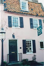
Pink House Gallery
Now, walk down Church Street past the Huguenot Rectory, and look
across the street at the large building with the balcony and the
prominent earthquake bolts. This is the Dock Street Theatre, thought to
be the oldest theater still used as a theater in the country. The first
play there was performed in the year it was built, 1735, and was titled,
"The Recruiting Officer."
Dock Street Theatre
In 1809, Alexander Calder and his wife converted the theater into
the Planters Inn Hotel, and added to the buildings. Later in 1855, J.W.
Gamble installed the present entrance on Church Street and added the
stone columned porch and the balcony. Some say that the first
"Planters Punch" was concocted here. In 1935, this building
was in ruins, along with the rest of the city, when it was restored by
the City of Charleston as part of a Works Project Administration
project. The theater is a replica of an 18th century London theater. The
reception room has the Adam mantles and stucco from the Thomas Radcliffe
House torn down in 1935. In 1935, 200 years after it first opened as a
theater, it reopened as a theater, with exactly the same play, "The
Recruiting Officer.''Turn around across the street from the Dock Street Theatre, and
look at the Church. This is the oldest active French Huguenot Church in
this country. That could have a great deal to do with the fact that its
the only active French Huguenot Church in the Western Hemisphere. This
is the third French Church to stand on this site. The first was known as
"The Church of Tides." Built in 1687, by the first wave of
French Protestants who realized that trouble was brewing in France, the
first church stood on what was known as Dock Street because the water
came up almost to the Church. The rise of the Huguenots was dealt with
earlier, but it's hard to imagine how meteoric it was. They went from
being boat people to wealthy rice planters in a matter of years.
The plantations were way up the rivers, however, and being very
religious, they felt they had to go to church each Sunday. There were no
chapels out in the country back in the early days (these are known as
"chapels of ease" and many of them still exist up in Berkeley
County to the northwest of Charleston, but they were all Church of
England.) There was also no road system, so the only way the family
could get to church was by longboat,
and the only way they could get these longboats down the creeks was at
high tide, thus the church had to schedule its services each week around
the tide. That structure was actually blown up in 1796 in a failed
attempt to stop a huge fire from spreading. The present structure was
built in 1845 by Edward Brikell White, one of the foremost architects
Charleston ever produced, and is of the Gothic Revival Style. It's
interesting that this church is active today.
Queen
to Cumberland
As you walk up Church Street, you will see on your left the house
with an anchor; this is the Pirate's House we told you about when we
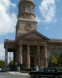
talked about Stede Bonnet. The Church ahead of you is St. Philip's
Episcopal Church Edward
Brickell White copied from St. Bride's Church in London, after the
disastrous fire of 1835. It boasts the oldest congregation South of
Virginia. They claim 1670, but they didn't get a minister until 1681.
The reason they can claim the original date is because in John Locke's
Fundamental Constitution, it was postulated that a church could be
formed if they had seven people of "like mind." Simple enough,
they had a quorum. Now the minister they got in 1681 was quite a fellow.
Apparently he was not well liked in England and was sent over here. The
last straw came when the vestry set him up. The last thing he did
officially as Rector of St. Philip's parish was to get extremely
inebriated and baptize a bear cub given to him by the parishioners. Many
may have found this somewhat hilarious, but the Church did not, and he
was dismissed.
The first church was a frame structure at the corner of Broad and
Meeting Streets where St. Michael's is today. The brick church was built
in 1710 when the wooden structure burned. The original St. Philip's on
this site was completed in 1723. It caught fire 1796, but was saved from
burning to the ground by a black boatman who was rewarded with his
freedom for his act of courage. During this period, it was described as
the most elegant church in the colonies, but this structure was
destroyed in the conflagration of 1835.
The bells of the church that ring at 9 a.m., 12 noon, and 6 p.m.
are not the original ones. The originals were donated to the Confederacy
during the War Between the States.During the siege of Charleston, St. Philip's was damaged
extensively by the federal bombardment. It was fixed then damaged again
by the earthquake, fixed, then hit by lightning in 1924, restored again
in 1925, and then twisted by a tornado in 1938. Today it seems to be in
pretty good shape, although it was battered a bit by Hurricane Hugo in
1989.
Notice it has two graveyards. The East graveyard was for natives,
and in 1768 the West graveyard, sometimes known as "the Stranger's Graveyard," was set aside in 1768 "for Strangers and
transient white persons."
By 1800, this was no longer true. There are a few notables buried in
both graveyards, including Charles Pinckney, a signer and co-author of
the Constitution is buried in the churchyard, as well as Edward
Rutledge, a signer of the Declaration of Independence. However, the most
prominent person to have been buried in St. Philip's was buried there
three times. John C. Calhoun was one of two people to have been
vice-president under two administrations, both John Quincy Adams and
Andrew Jackson. He was Speaker of the House and Secretary of War and
Secretary of State, he was the Great Nullifier and Father of Secession.
He realized that the agricultural South was not getting a fair deal in
the tariff laws the industrial North was demanding. When he died in
1850, he was laid to rest in the West or "Stranger's
Graveyard." In 1865, towards the end of the War, some vestrymen
were concerned that his body might be desecrated by marauding Union
Troops for he had, after all, been "Father of Secession," so
they hid him in angrave in the East graveyard. The unmarked grave is thought to be
where the chapel is today. After the threat passed, years later, he was
returned to the West graveyard where he is currently in residence.
As you walk to Cumberland Street, you'll see St. Philip's parking
lot and across that parking lot one of the oddest structures on this
tour. This is the Old Powder Magazine. The oldest public building in
South Carolina, it dates from c. 1703-1713, and is the only public
building to have survived the Charleston Wall. It was used as a powder
magazine until after the Revolution. The walls of the Powder Magazine
are quite thick, but the roof, in comparison, is somewhat thinner.
That's because if the building were ever to explode it would fly
upwards, not outwards. As it has never blown up, we are forced to accept
that this is true. It is now a museum open for tours.
Powder Magazine
The
City Market
Cumberland
to Market
The office buildings you see to your left were once a carriage
factory. You may see railway lines that have been covered by asphalt
along here. It should be noted that these are not trolley tracks. This
whole area was warehouses during the Second World War, and the tracks
ran from the port of Charleston on the eastern side of the peninsula to
these warehouses where containers were stored until needed.
Corner
of North Market and Church
This was Daniel's Creek, it was a tidal creek up until the early
1700s, when it was filled in. You’ve probably wondered this whole time
about the wall. Well some of it, a very tiny bit of it, survives in the
old Customs and Exchange Building. What happened to the rest of it?
Well, there are those who believe that at this very minute you're
standing on top of it. The wall disappeared roughly about the same time
the creek was filled in.
When it was filled in all of this land belonged to the Pinckney
family, signers of the Constitution. In the 1780s all of the land which
was once the Pinckney estates was donated to the city with two
stipulations: one, it always remained a "Publick Market," and
two, that no slave ever be sold on this land. If a slave had ever been
sold here, the land would have reverted to the Pinckney family. (There
are many Pinckney descendants today, and this is probably one of the
most valued pieces of real estate in the state today.)
So, the market was never a slave market. It was, however,
a meat market. If you have occasion to walk down by the large building
at the corner of Meeting and Market, that is Market Hall. Note the
frieze around the building under the eaves. The figures are ram's heads
and steer's heads. In the old days, they would lead a steer into the
open part, where they'd slaughter it, butcher it, chop it up, keep all
the good parts and throw all the scraps in the street. You might well
think that it would get rank around here, especially in August, but it
didn't. A number of turkey buzzards lined the roofs of the market, and
every time a scrap was thrown out, a turkey buzzard would swoop down and
eat the refuse. Now of course any city like Charleston with all of its
elegance, couldn't possibly call a turkey buzzard a "buzzard!"
We called them "Charleston Eagles." There are those who would
claim that, ergo, we had the first "eagle snacks."
We've tried to give you an impression of our city, and we
certainly hope we've done that. One thing we haven't been able to
convey, though, is the
accent. It's called Gullah, and it really is listed as a language, not
an accent. It's a mixture of English, French, and African dialects that
is unique unto itself. Probably, the leading authority on Gullah living
today is Mrs. Virginia Geraty who has a tape available.
There are those who claim that Charlestonians have two ways of
speaking. One when they speak to each other and the other when they
speak to the rest of the world. Charlestonians have often been compared
to the ancient Chinese. At first that may seem kind of strange. If you
stop to think about it, however, it's not that strange. In China people
live on rice and worship their ancestors, where as in Charleston people
live off their ancestors and worship rice!
Thanks
for taking this tour and we hope you have enjoyed it.
©David
A. Farrow
Thank
you David Farrow for your generosity in lending this walking tour.
|